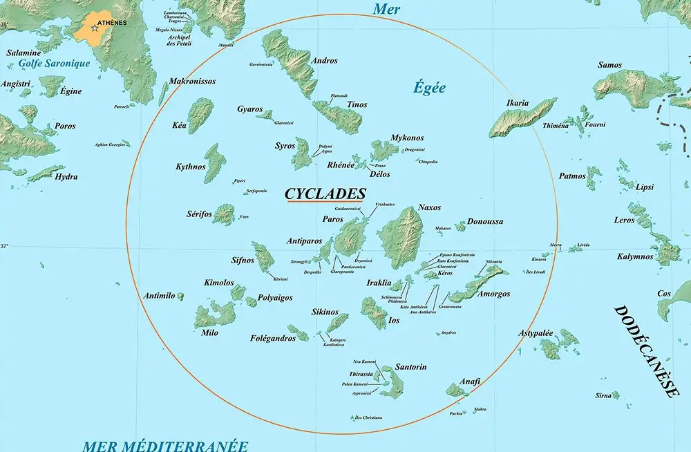
Cyclades Guide
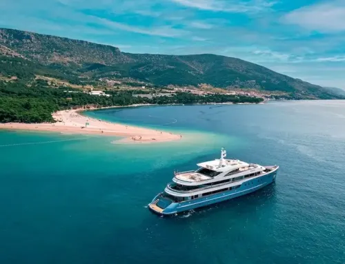
The Cyclades are the most well-known group of islands in the Aegean, and they are also home to some of the most stunning destinations in all of the Mediterranean when charter a yacht in Greece. A trip to the Cyclades is one of a kind due to the charming architecture that is predominantly white and blue in color, the traditional way of life, the island songs, the warm hospitality, the land that is devoid of vegetation and is dotted by deserted country chapels, the breathtaking coastline, and the excellent sandy beaches. All of these elements come together to form a harmonious blend.
Greece Cyclades Guide Map Europe Yachts
The combined land area of the islands is 2,528 square kilometers. Only 25 of the 2,200 islands, islets, and smaller rocks that make up the archipelago are now inhabited. Ermoupoli, the nation’s capital, may be found on the island of Syros. The phrase “the islands that form a circle” encircling the holy island of Delos is where the word “Cyclades” originates from. According to Greek mythology, Poseidon (or Neptune) is responsible for the formation of the Cyclades islands. When the Cyclades nymphs earned Poseidon’s anger, he transformed them into islands. Cycladic culture flourished between 3200 B.C. and 1100 B.C. (Early Cycladic, Middle Cycladic, and Late Cycladic Period), when the islands, due to their geographic position, became a trade and cultural center. The Cyclades have been inhabited since prehistoric times; however, the Early Cycladic, Middle Cycladic, and Late Cycladic Periods. The development of the region came to a standstill in the 16th century B.C. as a result of an eruption of the volcano on the island of Thira (Santorini). After a few centuries, Dorians began settling in what is now known as the Cyclades. The islands of the Cyclades were part of the Aegean Theme (Administrative Division) during the time of the Byzantine Empire. Later, these islands came under the control of the Venetians and the Franks. During the time that Turkey occupied these islands, they were subject to repeated attacks by pirates, which is why the Turkish government gave them permission to construct ships so they could fight back against the pirates. Following the signing of the Treaty of London in 1830, the islands were finally granted their independence and incorporated into the Greek state.
Today, millions of tourists from Greece and other countries visit the islands of the Cyclades in search of the brilliant sunlight and crystal blue waters that they believe would help them experience their own version of a “magical vacation.”
Kea Island Cyclades Guide Europe Yachts
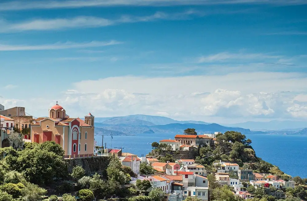
KEA (TZIA)
Because of its close proximity to the eastern coast of Attica, the stunning island of Kea, also known as Tzia, is one of the most popular vacation spots in all of the Cyclades. It has a population of 2,420 people, an area of 130.5 square kilometers, and 81.5 kilometers of coastline. The island is home to a variety of landscapes, some of which are high mountains, little farms, olive orchards, vineyards, ravines, scenic coves, and isolated beaches. The area was populated for the first time during the Late Neolithic period, which lasted from 3300 BC to 3200 BC. The Bronze Age was a time of significant cultural growth during this time. Ioulida, Karthaia, Korissia, and Poiiessa were the four city-states that were established during the Archaic period (7th-6th century B.C.). These city-states communicated with one another by an elaborate network of roads. Ioulida and the surrounding area had the greatest increase in the number of people living there during the Byzantine period. Ottoman Turks inhabited the island of Kea beginning in 1566 and leaving in 1821. As a consequence of the subsequent development of mines and factories as well as the establishment of a bustling commercial port on the island, it enjoyed a great deal of success over the subsequent period of time.
KYTHNOS Island Cyclades Guide Europe Yachts
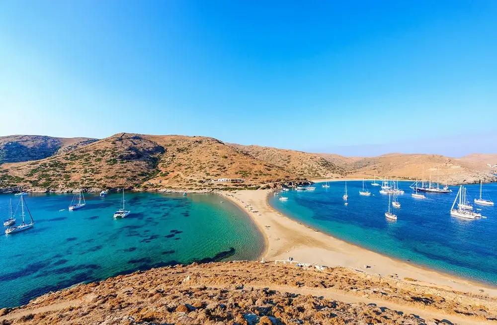
KYTHNOS
Despite the fact that Kythnos (also known as Thermia owing to its hot springs) is one of the Cyclades islands that is located in the closest proximity to Attica, it is nonetheless one of the less well-known regions of the Aegean. The northern section of the island is where you will find Merichas, which is the island’s harbor, Chora, which is the capital, Loutra, and Dryopida. Only the region of Panagia Kanala and the little harbor of Agios Dimitrios are inhabited in the southern section of Kythnos; the rest of the land in that region is almost desolate. The island is home to sixty-five beautiful beaches, the most of which are accessible by unpaved roads, as well as scenery typical of the Cyclades, which include barren hills and dry stone walls that reach for a considerable distance. The island is sprinkled with 350 gorgeous snow-white rural chapels, and the towns have small streets covered with cobblestones, snow-white buildings, squares, churches, and windmills. The island is also home to some of the world’s oldest windmills. The Dryopes, also known as the Dryopians, arrived in Kythnos about the 10th century BC from the island of Evvoia (also known as Euboea). The island was prosperous throughout the classical era, and it sent a trireme, which was an ancient Greek galley, to participate in the naval battle of Salamina. The island experienced the same historical events as the other islands in the Cyclades group: in 1204, it fell under the dominion of the Venetians, and it was afterwards captured by the Turks. In 1830, it became a part of the newly established state of Greece. There are 1,600 people living on the island, which has a total size of 99 square kilometers and 111 kilometers of shoreline.
SERIFOS Island Cyclades Guide Europe Yachts
SERIFOS
Serifos is a classic Cyclades island, making it an excellent destination for laid-back holidays. It is home to peaceful tiny harbors, snow-white settlements, and golden sandy beaches. In addition, the island is home to high masses of rock, hills with no vegetation, and magnificent beauty. It is located between Kythnos and Sifnos, and despite the small increase in tourism that has occurred there, the island’s traditional characteristics have not changed. Mythology has it that Perseus came on the coast of Serifos with his mother Danae stowed away in a box when they reached Serifos. As a means of exacting revenge against Polydefkis, King of Serifos, he beheaded the Gorgon Medusa and presented the severed head to Polydefkis. This caused Polydefkis to turn to stone. There are abundant natural resources to be found on the area of Serifos, which brought about a great deal of wealth to the island, particularly after the sixth century BC. During the Medic Wars, the inhabitants of the island joined forces with the Delian League to fight against the Persians. In later years, the island fell under the control of the Macedonians, followed by the Ptolemies, and in the end, the Romans. Following the Crusaders’ successful siege of Constantinople in 1204, the island of Serifos was handed up to nobility from Venetian territory. It was taken by the Turkish admiral Barbarossa in 1537, and then it was occupied by the Russians from 1770 till 1774. Following the events of 1821, it along with the rest of the Cyclades was freed.
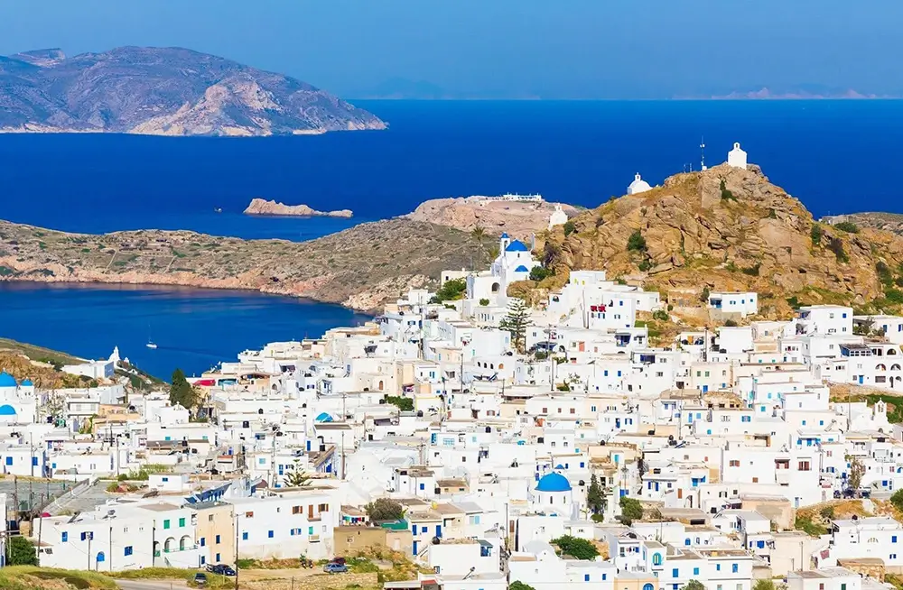
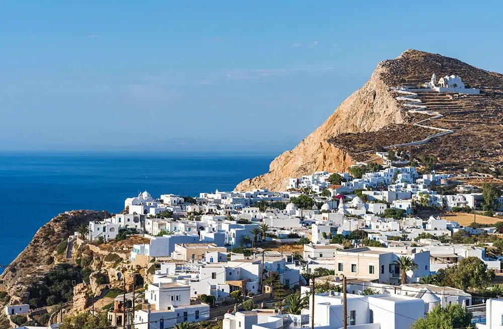
SIFNOS Island Cyclades Guide Europe Yachts
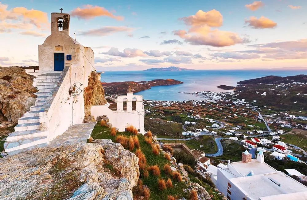
SIFNOS
The image of Sifnos is comprised of traditional village homes that have been whitewashed, an abundance of churches, attractive dovecotes and windmills, and beaches with water that is crystal clear. The gold and silver mines and quarries of “Sifnios lithos” contributed to the island’s prosperity in ancient times, which allowed the island to thrive (a local stone). From 1687 until 1854, it served as a significant cultural center and was home to the illustrious School of Agios Tafos (Holy Sepulchre), also known as Paideftirion tou Archipelagous (The Archipelago Educational Establishment). The art of pottery has a long history on the island, and there are several ceramics and pottery studios available to the public today. Between the islands of Serifos and Milos is where you’ll find Sifnos. The island has a total population of 2,450 people and an area of 74 square kilometers. Its shoreline is 71 kilometers long.
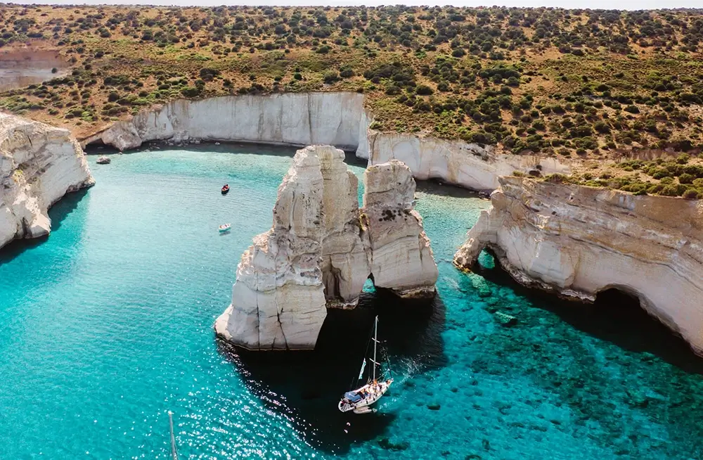
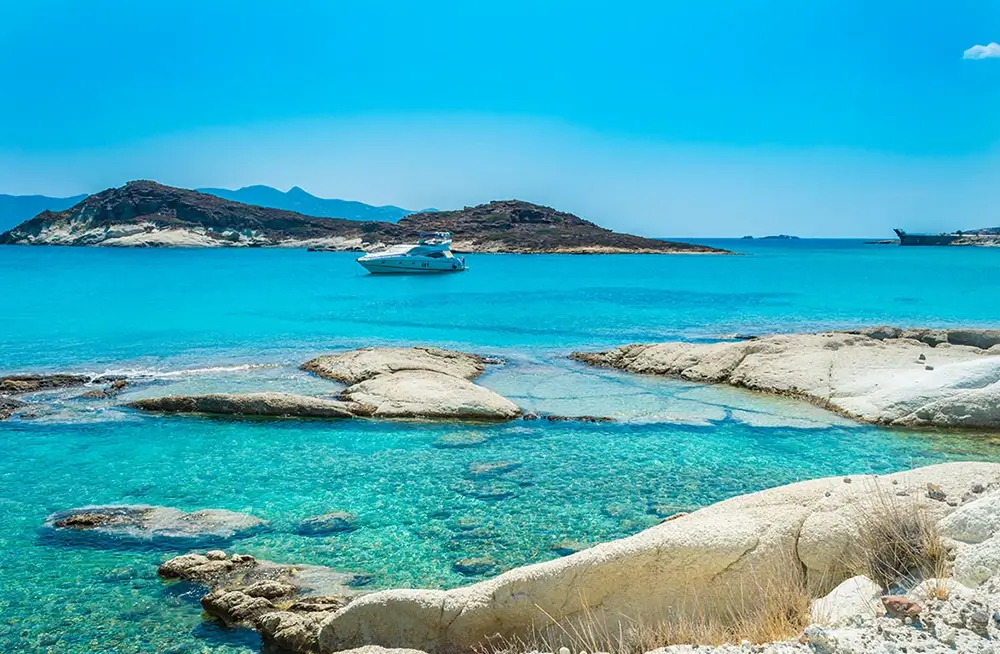
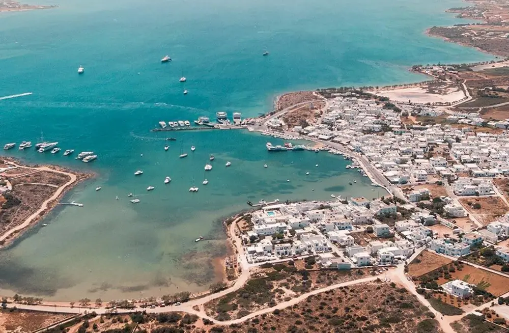
MILOS Island Cyclades Guide Europe Yachts
MILOS
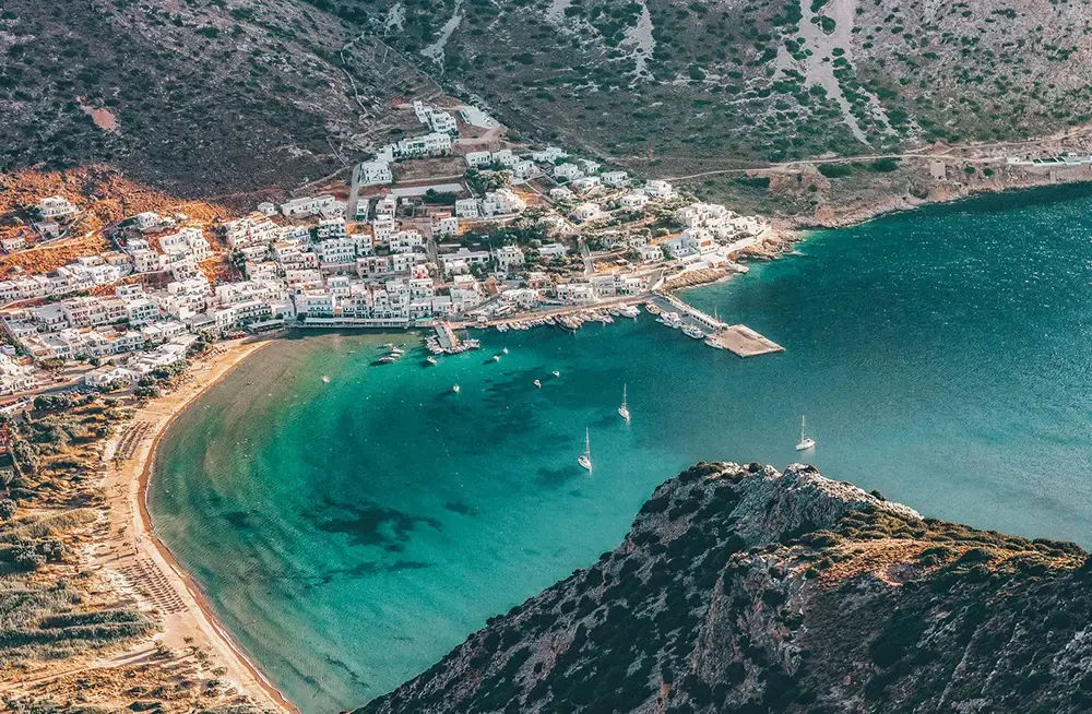
Milos is the fifth biggest island in the Cyclades group and is situated in the southwestern most point of the Cyclades. It has a population of 4,770 people, a land area of 151 square kilometers, and 126 kilometers of coastline. The island’s volcanic topography is responsible for the unusual forms of its rocks, the gorgeous colors, the entrapping white sandy beaches, and the carved rocks. The island of Milos has an abundance of mineral resources. During those prosperous days on the island, one of the primary contributors to the economy was the mining of obsidian, which is a rock made of jet-black volcanic glass. This is the site of one of the mines that is considered to be the oldest in the Mediterranean.
Since prehistoric times, people have been living on the island of Milos. In the naval battle of Salamina, which took place during the Persian Wars, the locals fought against the Persians. Later, during the Peloponnesian War, they maintained a neutral posture and did not choose sides. During Roman times, business was booming. During the Byzantine era, the island was subject to regular attacks by pirates, and the inhabitants sought safety in the caves and coves located on the island’s southern side. After that, the Venetians and then the Turks took control of the island in its final years. The extraction of perlite, kaolin, and bentonite began in the 20th century and continues to this day in the Milos region, which has developed into a significant mining sector.
KIMOLOS Island Cyclades Guide Europe Yachts
KIMOLOS
Next to Milos is where you’ll find the island of Kimolos, which belongs to the Cyclades but is further west. It only has a population of 770 people and a land area of 39 square kilometers, but it has a coastline of 38 kilometers and a total land area of 39 square kilometers. It is an island that was formed by volcanic activity and has a bewildering range of rock formations, including bentonite, also known as chalk land, which is a sort of main rock that was utilized in the production of porcelain. Beautiful beaches of fine sand and stones may be found in tiny, scenic coves all over the island of Kimolos. It is a safe haven for the Mediterranean monk seal, Monachus monachus, which may be found there.
The history of Kimolos has always been related to that of Milos since the two islands have experienced the same fate. Arzantiera was the name given to the territory by the Venetians after they took control of it in the middle ages. Due to the frequent attacks by pirates that took place there while it was under Venetian and Ottoman administration, the area had nearly completely lost its population by the late 18th century.
The island’s administrative center is really a combination of two villages: the Old Village and the New Village (Chorio). The Old Village, which was constructed around the historic core of the mediaeval castle, embodies all of the characteristics of the architectural style of the Cyclades and is very charming. The original structure of the castle was constructed in the 13th century, and its outer wall was made by homes that featured windows called embrasures. During the years when pirates roamed the island, the locals would take refuge in the castle until the start of World War II. The New Village was constructed in the 17th century on the outside side of the castle, and it extended all the way around the Old Village. The structures in the New Village were square and austere, in contrast to the domes and arches that were typical of the buildings in the Old Village.
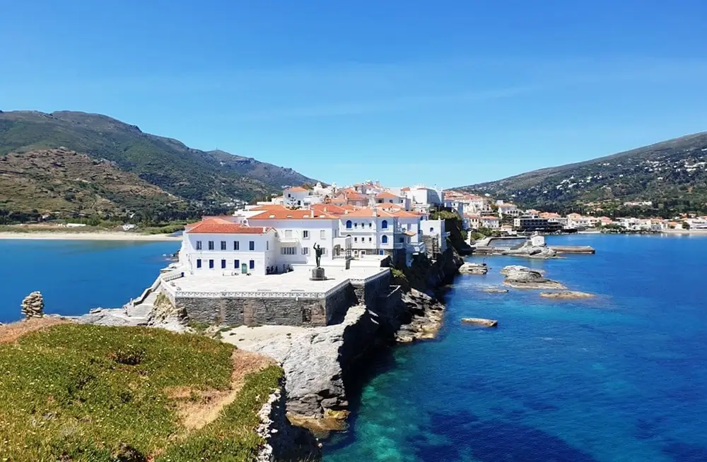
ANDROS Island Cyclades Guide Europe Yachts
ANDROS
Andros, the most northern island in the Cyclades, has a long and storied legacy of maritime endeavors. Sand beaches, rocky shores, and mountain ranges are interspersed by fertile plains that are covered with lush flora and have a number of streams running through them. The island of Andros has historically been regarded as the region’s primary entry point to the Aegean Sea.
There are 10,000 people living on an island that has a total size of 400 square kilometers, 177 kilometers of shoreline, and a population of 400 square kilometers.
In antiquity, it was a civilization that stood out for its impressive level of cultural sophistication and organization. It has been inhabited from prehistoric times. In the seventh century B.C., the people who lived there established several colonies in Macedonia. Andros was under the occupation of the Venetians until 1566, when it was taken over by the Turks. Near the north-western beaches of the island, in the Kafireas strait, a conflict between Turkish troops and a fleet commanded by Lampros Katsonis resulted in the fleet’s severe devastation in the year 1790. Andros was a participant in the War of Independence for Greece in 1821. The philosopher and scholar Theophilos Kairis was one of the most notable figures of his day.
TINOS Island Cyclades Guide Europe Yachts
TINOS
Tinos is one of the most interesting islands, despite the fact that it is not very well-known. It is situated in the northern Cyclades, between the islands of Syros, Andros, and Mykonos. Tinos Island is connected in the minds of the Greeks with the Church of Panagia Megalochari (Mother of God of Great Joy), an icon of which is revered by the thousands of Christians who make their way to the church on August 15 of each year in order to pray, seek spiritual guidance and solace, and pay their respects to the Mother of God.
As a result of the fact that most people only stay on Tinos for a single day in order to perform their religious observances, the majority of tourists never get the chance to experience the island’s breathtaking landscapes or its many fascinating attractions, despite the fact that Tinos is widely known as a religious center. Traditional settlements, the world-famous dovecotes, and exquisite country churches may be found in the hilly interior of the Cyclades, where you will also discover the gorgeous villages that are so characteristic of the region.
Tinos was once a colony of Eretria town and subsequently became an Athens colony. This began in the eighth century BC. The Gizi family held ownership of the territory from 1207 until 1390, after which it was taken over by the Venetians. Marble sculpting, as well as other forms of craft and art, have a long legacy on the island. Tinos was the birthplace of a great number of well-known sculptors and painters of modern Greece. There are 8,500 people living on an island that has a total size of 194.5 square kilometers, with 114 kilometers of shoreline.
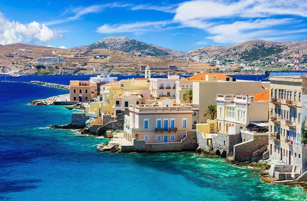
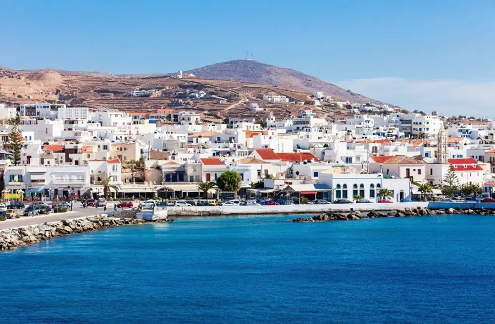
SYROS Island Cyclades Guide Europe Yachts
SYROS
The moment you say Greek islands, images of Santorini sunsets and Mykonos lanes immediately spring to mind. Together, these scenes provide an exquisite picture of summertime beauty. Syros is the administrative center of the Cyclades group of islands and one of the smallest of the islands in that group. If you want a taste of Greek paradise without the crowds, Syros is your best chance.
As soon as the ferry pulls into the harbor, the island of Syros presents itself with its stunning pastel-colored homes that cascade down the Ermoupoli hill and shimmer in the sunlight of the Aegean Sea. Syros is a complex island with a long history and a culture that has been shaped by its previous rulers. It is also home to two cities, one of which is Orthodox and the other of which is Catholic. The island is full of pleasant surprises.
During the Greek War of Independence in the 1820s, a wave of refugees from other Greek islands such as Chios, Psara, and Crete arrived on the island of Syros, which led to the establishment of Ermoupoli (also spelled Hermoupolis). Ermoupoli was originally founded as an extension to the already existing settlement of Ano Syros. The new residents were responsible for the town’s transformation into a major commerce center that connected the east and the west, and they contributed their abilities to the subsequent cultural explosion that ensued. The establishment of printing presses, schools, and museums occurred quite quickly. The ‘City of Hermes,’ which was appropriately called after the Greek god of trade, grew its amphitheatrically arranged layout with neoclassical structures, crayon-like palaces, and stunning cathedrals as a result of the development of the bourgeoisie and the thriving arts. The magnificent Town Hall, which is located on the Plateia Miaouli, which is filled with cafes, the Apollo Theatre, and the blue-domed Agios Nikolaos Church are the most notable landmarks in the area.
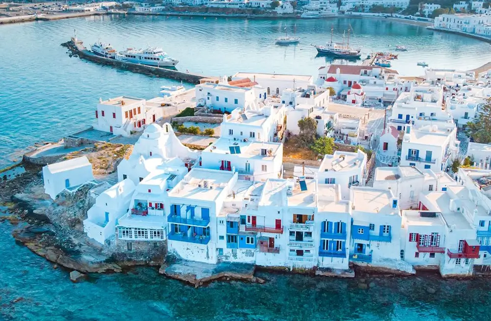
MYKONOS Island Cyclades Guide Europe Yachts
MYKONOS
One of the most well-known sites for tourists all around the world! The Greek island of Mykonos is one of the most famous islands in the world, and it is a popular vacation spot for famous people from all over the world.
It is one of the most beautiful islands in the Cyclades, with barren hills, breathtaking sandy beaches, a Cycladic architectural style that has been extremely well kept, little white churches, and landscape of a beauty that is unparalleled. In the most recent decades, a great number of villas and hotels have been constructed in a style that is consistent with the physiognomy and architecture of the island.
Between the islands of Tinos and Naxos is where you’ll find Mykonos, which puts it roughly in the middle of the Cyclades group of islands. It has a population of 9,350 people, an area of 87 square kilometers, and 82 kilometers of shoreline. It is the island that is located closest to Delos. There is an airport on the island that is connected to the cities of Athens and Thessaloniki as well as other places in Greece.
It is important to keep in mind that Mykonos, particularly in the summertime, may get very crowded; hence, if tranquility and seclusion are priorities for you, visiting this location is not a good idea.
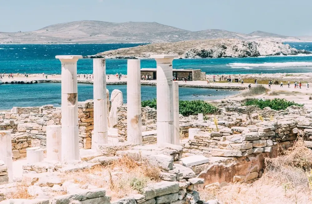
DELOS Island Cyclades Guide Europe Yachts
DELOS
According to Greek mythology, Apollo, the god of light, was born on the island of Delos, which is located in the middle of the Aegean Sea and has an area of six square kilometers. Delos was an important religious and cultural center throughout ancient Greek times. The ancient Greeks thought that the island, which was once known by the name “Adelos – Asteria” (Adelos meaning “not visible”), was actually floating on the water. When Apollo was born on Adelos, the island was transformed into Delos, which means it became visible, and it was filled with light and flowers. The island is said to have been secured to the ocean floor during that time, according to the tale. Since 1000 BC, the island of Delos has served as a religious center throughout the Greek Ancient Ages, and since 478 BC, it has also served as a commercial center. Although there are no people living on the island at this time, there are tiny boats that leave the port of Mykonos, which is located nearby, every day to visit the island (the distance is 6 nautical miles).
Around 2500 BC, the island of Delos was first settled by humans. The Carians were the first people to settle in the area, followed by the Mycenaeans. Around 1100 B.C., the Ionians established a settlement on the island. Delos had already been established as the religious center of the Ionians by the time 700 BC rolled around. It was there that the Ionians conducted their Great Assembly in addition to other Panhellenic gatherings. Numerous oblations were presented to the holy island by the towns of Paros, Naxos, Samos, and Athens, amongst a great number of other Ionian settlements. When the Persians arrived to conquer the island, they were respectful of its religious significance. It was in this location in 478 BC that the first Delian League, also known as the Athenian League, was founded with the intention of defending the Ionian cities against the Persians. At the beginning of the third century B.C., the Athenian power began to wane, and the Macedonians began to exert their authority over Delos. Apollo’s holy island began its transformation into a prominent financial and commercial hub about the middle of the third century BC, when affluent merchants and bankers began to settle there. During the time of the Roman empire, the island was made into a free commercial port, and prosperous Roman merchants and ship owners settled there. At that time, there were 20,000 people who called Delos their home, including Romans, Egyptians, Syrians, Phoenicians, and Jews.
Mithridates, King of Pontus at the time, obliterated the island in 88 BC, which resulted in the island losing all of its holy significance. The island’s population began to dwindle throughout the early years of the Christian era, which coincided with Delos’s gradual but steady descent into an unstoppable decline. After the iconoclast Byzantine Emperor Leo the Isaurian had pillaged the island, whatever relics left over from the island’s former days of splendor were destroyed.
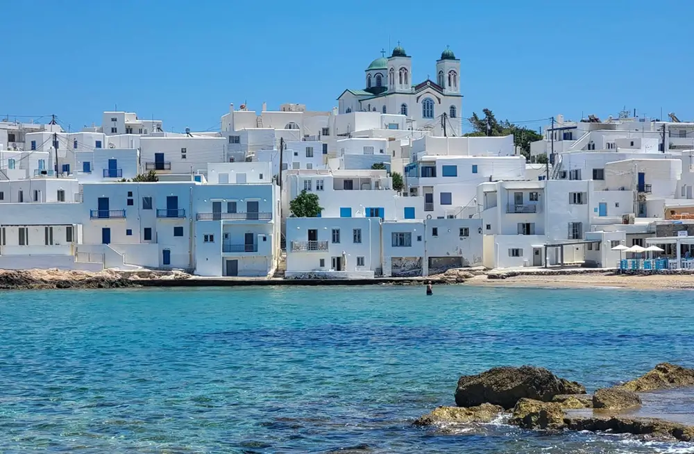
PAROS Island Cyclades Guide Europe Yachts
PAROS
Because of its unparalleled natural beauty, expansive sandy beaches, crystal clear waters, and breathtaking landscape, the island of Paros is widely regarded as one of the most popular holiday destinations in all of Greece. Paros is located in the middle of the Cyclades islands. The island has a population of 12,800 people and an area of 195 square kilometers. Its shoreline stretches over 120 kilometers. This location is a cosmopolitan vacation hotspot that has an advanced tourist infrastructure. Throughout its history, the island of Paros has played an important role as the administrative and commercial center of the Aegean. However, the island has also been the source of contention for numerous conquerors, including the Romans, the Byzantines, the Franks, the Venetians, and the Turks, all of whom have left their mark on the island. The ruins that may be found in archaeological sites and the significant historical monuments that can be seen all over the island are evidence of the island’s enormous wealth in the distant past. In ancient times, the island of Paros was famed for its marble, which provided the material for the construction of several well-known structures. This island is where many prominent ancient Greek sculptors, painters, and writers got their start in their respective fields. Following its incorporation into the Duchy of the Aegean in 1207, Turkish forces eventually managed to take control of the island of Paros in 1537.
ANTIPAROS Island Cyclades Guide Europe Yachts
ANTIPAROS
The islet of Antiparos, which is located right close to Paros, is a wonderful place to go on vacation if you’re looking for some peace and quiet. It has a population of 1,030 people and an area of 38 square kilometers. The shoreline is 37.5 kilometers long. The island’s terrain has been drastically transformed by an unidentified disaster, which has led to the majority of the area being uninhabitable today. With ancient times, the island was covered in lush flora. Oliaros was the name that Antiparos was known by in ancient times. On the neighboring islet of Saliagkos, archaeologists have discovered the remains of a Neolithic community that is considered to be the oldest one ever found in the Cyclades.
It is located 4.5 nautical miles from Paroikia and 1 nautical mile from the settlement of Pounta on the Greek island of Paros. There is a link between these communities and the ferry.
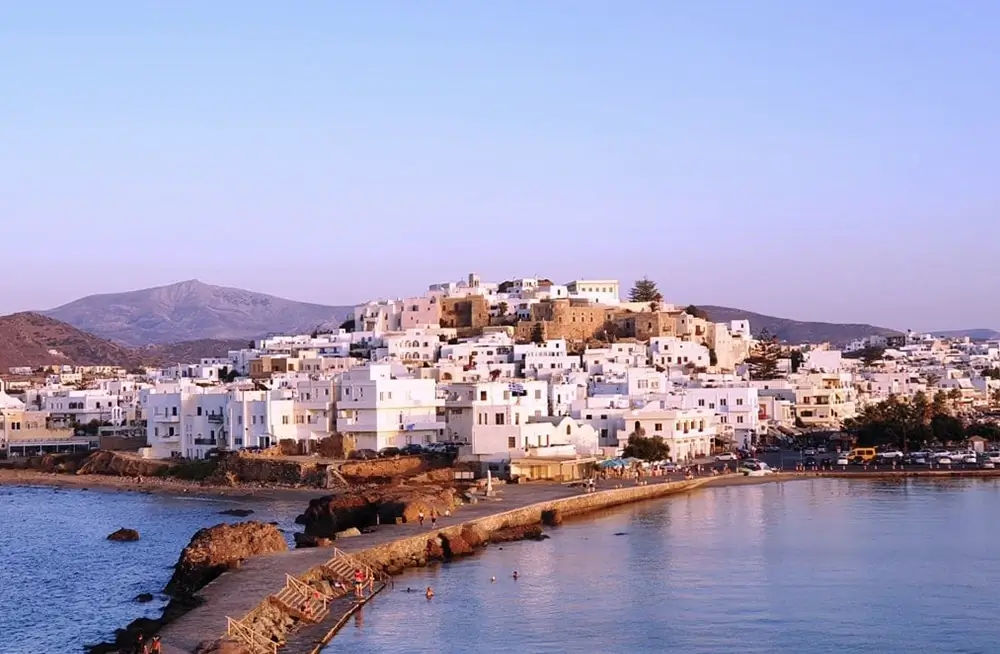
NAXOS Island Cyclades Guide Europe Yachts
NAXOS
In the Cyclades, the island group known as Naxos is both the biggest and the most fertile. It is equipped with a spectacular terrain, high mountains (the summit of Mount Zas is 1,004 meters high, making it the tallest peak in the Cyclades), and highland communities that each have their own distinct personality. It has an area of 428\ssq. km, a coastline of 148 km and a population of 18,000. On the island, worship of the deity Dionysus was practiced throughout ancient times. According to legend, Dionysus encountered a Minoan lady, Ariadne, who had been abandoned by Theseus at Naxos. Since ancient times up until the present day, the island has been producing citrus fruits of an exceptional quality, wine that is well-known for its quality, and several types of cheese that are exceptionally delectable.
Carians were the first people to settle on the island of Naxos, followed by Cretans and Ionians in that order. In ancient times, the island of Naxos was already well-known for the quality of its wine and for being a center of worship dedicated to the ancient deity Dionysus. Naxos enjoyed a prosperous period in terms of commerce, finance, and culture throughout the sixth century B.C., during which time it was also a member of one of the Athenian or Delian Leagues. The Duchy of Naxos was established by Marco Sanudo in the time of the Venetian domination (1207). The Venetians occupied the island all the way up until the year 1566. In the year 1579, it was annexed to the Ottoman Empire, and starting in the year 1830, it has been a part of the Greek state.
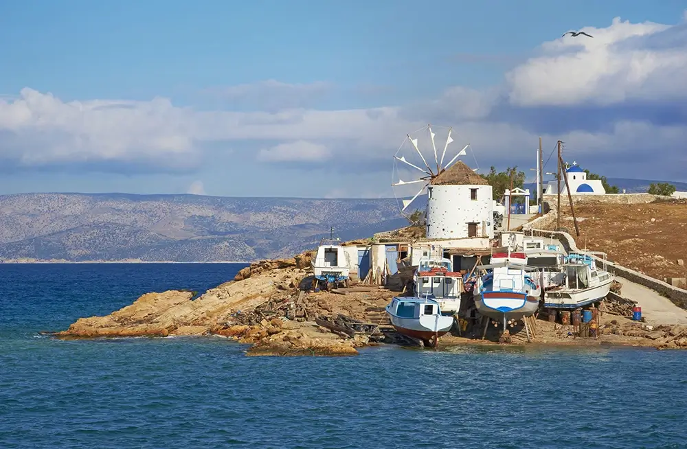
SMALL CYCLADES Island Cyclades Guide Europe Yachts
SMALL CYCLADES
SKINOUSA – DONOUSA KOUFONISIA – IRAKLIA
The little Cyclades are well-known for their breathtaking sandy beaches that go on for miles. But what really sets them apart from other islands in the Cyclades is the fact that they are shielded from the fierce winds that often blow there.
Because of this, sailing vessels choose using them as natural ports rather than artificial ones.
The combination of their natural splendor and the beautiful, rocky scenery of the Cyclades creates an atmosphere that is mesmerizing! Tourists who would rather escape the hustle and bustle of the crowds to enjoy some quiet time drawn to this breathtaking location.
The six tiny islands that lie between Naxos and Amorgos have been through millennia of civilisation and upheaval, from being densely populated trading centres in the days of antiquity and then fortified Venetian outposts to pirate havens and impoverished fishing backwaters during WWII. However, they have recently re-emerged in the spotlight as increasingly fashionable getaways. Today, only four of these islands have permanent populations: Iraklia, Schinousa, Ano Koufonisi (Koufonisia), and Donousa. These islands continue to be quite different from one another in personality and topography, with Koufonisia in particular welcoming sun-worshippers, Schinousa and rugged Donousa appealing to hikers, and Iraklia being famous for its cave pilgrimage.
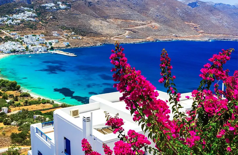
AMORGOS Island Cyclades Guide Europe Yachts
AMORGOS
This is the island that was used for the majority of the filming of “The Big Blue,” which was directed by Luc Besson and shot in Amorgos. It is distinguished by its location at the furthest eastern tip of the Cyclades and its own personality. The terrain of Amorgos is comprised of a mountainous environment with remarkable steep mountainsides and agriculture terraces with mediocre yields, steep cliffs near the coast in the southern half of the island, and attractive coves with lovely seashores in the northern portion of the island.
Since prehistoric times, people have lived on the island, and during the Cycladic Period, it was at its most prosperous. During that time period, Amorgos saw significant advancements in the areas of commerce, navigation, and the arts. Minoa, Arkesini, and Aigiali were the three significant ancient cities that stood on the island at one time. In Roman times, the island of Amorgos served as a place of exile for people. During the Byzantine era, the landmark that is known as the Panagia Hozoviotissa Monastery was constructed. The island was subject to a number of attacks when it was under the control of the Franks, and it was finally captured by the Turks in the 16th century. In 1821, Amorgos was one of the Greek islands that took part in the revolution against the Ottoman Empire. Every hamlet on the island exemplifies the ancient architectural style of the Cyclades, and each one is home to well-preserved local traditions, including music and rituals that have been passed down through the generations. Hikers are able to explore the island’s historical sites and take in the stunning scenery thanks to the extensive trail network that exists here. It has a population of 1,850 people, an area of 121 square kilometers, and 112 kilometers of coastline. Mount Krikellos serves as the highest point on the island (821 m.).
IOS Island Cyclades Guide Europe Yachts
IOS
Ios, also known as Nios by those who live there, is one of the most stunning islands in the Cyclades group. It is well-known all over the world and is favored by young people due to its vibrant nightlife. In addition to being encircled by Santorini, Paros, and Naxos, it is home to a plethora of bays and miles of sandy beaches. There are sandy beaches along 32 kilometers of the whole 81.5 kilometers of shoreline.
According to an old myth, Ios was not only the spot where the famous epic poet Homer was laid to rest, but it was also the place where Homer’s mother came from. At the site of Skarkos, archaeologists uncovered the remains of a settlement from the Early Cycladic Period as well as buildings believed to date back to historical times. During the Byzantine era, construction began on Palaiokastro, which is located in the north-eastern part of the island. Ios was dominated by the Venetians up until 1537, when Turkish forces took control of the island. It has a population of 1,830 people and an area of 108 square kilometers.
FOLEGANDROS Island Cyclades Guide Europe Yachts
FOLEGANDROS
The island of Folegandros will provide visitors with the opportunity to enjoy a genuinely peaceful vacation in a typical Cycladic scenery that has been preserved in its natural state despite rapid increase in tourism. Walking around the cobblestone streets of Chora (the main town) and the narrow alleys of the castle; climbing on the rock of Panagia where you will be able to feast your eyes on a panoramic view of the Aegean Sea; swimming at secluded beaches or at more popular ones; all of these activities are aspects that compose one of the most beautiful settings in the Cyclades. The island has a population of 670 people, an area of 32 square kilometers, and a shoreline of 31.5 kilometers. It may be found between the islands of Sikinos and Milos in the southwestern part of the Cyclades. Mythology has it that Folegandros, the son of King Minos of Crete, was the first person to settle on this island. Folegandros is said to have been the leader of the first immigrants who came from the island of Crete.
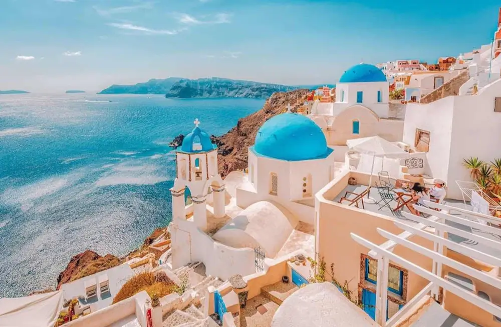
SANTORINI Island Cyclades Guide Europe Yachts
SANTORINI (THIRA)
Around the globe, Santorini is considered to be one of the most famous of the Greek islands. Following an eruption of its volcano in the 16th century B.C., the first island known as Strongyli (meaning Round) sank to the bottom of the sea, leaving only the remnants of what is now known as the island we see today. This makes it a singular geological occurrence in and of itself. This was one of the most violent eruptions in the history of Earth; as a result, three quarters of the island were flooded, which led to the formation of the Caldera that we see today. In addition, the most significant consequence of that eruption was the obliteration of the Minoan Palaces that were located on Crete. The island of Santorini has a total population of 13,670 people and an area of 73 square kilometers. The island’s coastline stretches over 69.5 kilometers.
The island of Santorini is the most southern of the Cyclades group of islands. The islands of Thira, Thirasia, Aspronisi, Palaia Kameni, and Nea Kameni make up the collection of islands that are known together as the island of Santorini (Kameni meaning burned). The architectural history of the island has been astonishingly well maintained in Fira and Oia, as well as in smaller settlements located farther inland. The island was home to a significant prehistoric civilization that flourished mostly during the Middle Cycladic Period but was eventually wiped out by an eruption of the island’s volcano. The island was eventually repopulated, and its economy prospered during the Hellenistic and Roman periods of history. Later on, Venetians occupied the island and stayed there for several centuries after taking control of it. The number of tourists visiting Santorini has increased dramatically during the past few decades. Despite this, the island has not lost any of its charm; there are still mysteries to be solved and untouched areas of natural beauty to be discovered, not to mention the breathtaking sunsets for which Santorini is famous all over the world. The island’s vines have been producing the region’s famed wine since ancient times, therefore the wine has a long history on the island. Asyrtiko, Athiri, Aidani, Mandilaria (red), and Mavrotragano are the types of grapes that are often produced in this region (red). Vinsanto is a wine that is made by blending two different types, specifically Asyrtiko and Aidani. This results in the wine’s remarkable quality.
About the Author: Europe Yachts Charter